


Morlaix shows that another approach is possible
Rivers in Brittany.
The planning choices we make today will shape Brittany for the next fifty years.
To save space, improve traffic flow or accompany their development, many have channelled, diverted or covered their watercourses.
Today, this vision is evolving.
In Morlaix, an ambitious project illustrates this change in perspective. Instead of solely focusing on controlling the river, the local authority first set about understanding how it works. For several years, scientific studies were carried out to analyse the underground channels, water flow, and flood risks.
This approach marks a break from past practices. Before building, one must know. Before transforming, one must observe.
At the heart of Morlaix, the Jarlot and the Queffleuth rivers meet to form the River of Morlaix before flowing into the bay. This configuration has shaped the town's history, its commercial development, and its landscape. It also explains why Morlaix / Montroulez remains particularly exposed to flooding.
For decades, the answer has been to enclose some of these waterways in underground structures. These developments reflected the knowledge and priorities of their time. However, flooding episodes now remind us that these solutions are no longer always sufficient in the face of more intense rainfall and increasing urbanisation.
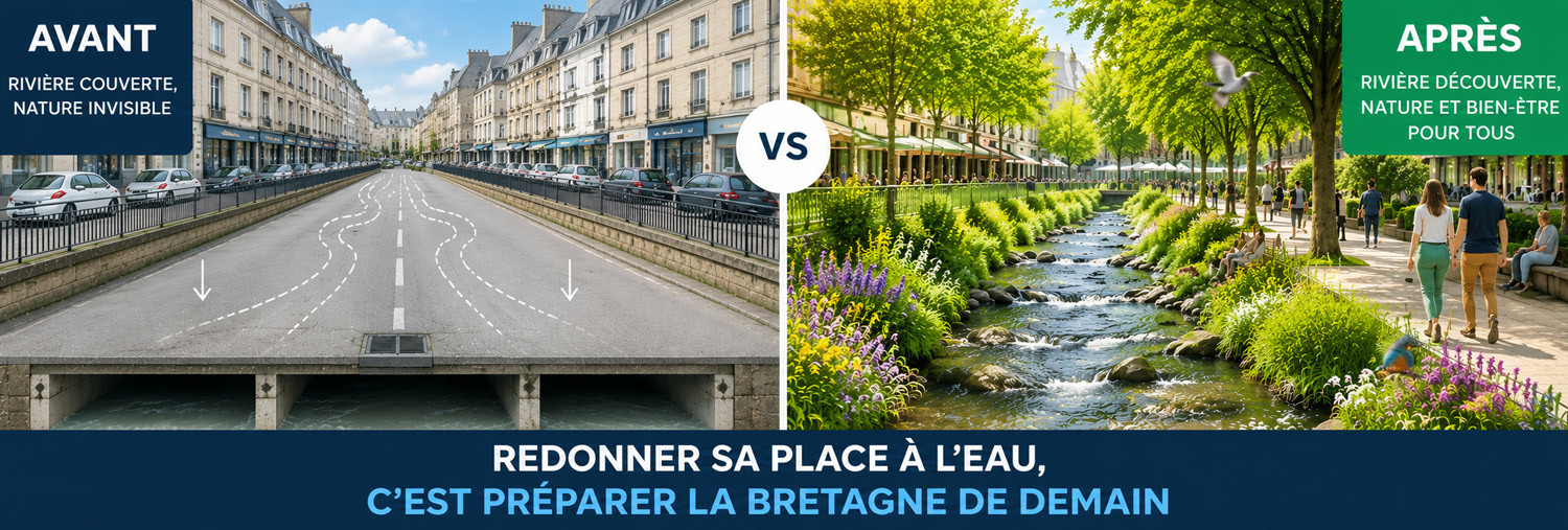
The current project pursues a different objective. It does not claim to eliminate risk entirely, but to reduce it durably while improving the living environment. The idea is to improve water flow in existing structures and to give a visible place back to certain river sections.
This approach presents several advantages.
Daylighting a river promotes biodiversity, helps to naturally cool urban areas during heatwaves, and restores a landscape identity that is often forgotten.
The example of Morlaix / Montroulez therefore extends far beyond the city limits. It raises a question that now concerns a large part of Brittany: how to develop our towns by working with rivers rather than systematically trying to restrain them?
It is precisely this evolution that is found today in many reflections on sustainable urban planning. Rivers are no longer seen solely as elements to be controlled. They are gradually becoming essential components of more resilient landscapes, capable of better withstanding the climatic challenges of the coming decades.
Why have we hidden so many rivers?
For centuries, rivers have been at the heart of Breton town life. They provided water, powered mills, facilitated certain artisanal and commercial activities, while also forming a structuring element of the urban landscape.
From the 19th century onwards, the situation gradually improved.
Population growth, industrialisation and urban development are leading many communities to profoundly modify their watercourses. Rivers are channelled, covered or sometimes diverted to free up new building land, create traffic routes or address the public health concerns of the time.
These choices were not driven by a desire to degrade the environment. They responded to the technical knowledge and needs of the time. Watercourses were then often perceived as obstacles to urban development, or even as potential sources of unhealthiness when wastewater was discharged directly into them.
This vision has long dominated urban planning, in Brittany as in the rest of Europe.
Yet, it has sometimes had unexpected consequences. By reducing the space left to rivers, some cities have increased their vulnerability to floods. During heavy rainfall, the water doesn't disappear because it circulates underground: it continues its course, but in structures whose capacity can be exceeded.
The more intense weather events observed in recent years are now prompting a rethink of this approach.
Scientists, urban planners, and communities increasingly agree on a simple principle: when a river is given more space to flow naturally, it can help to absorb excess water more effectively while offering numerous benefits to residents.
This evolution is not about going backwards or erasing two centuries of development. Rather, it invites us to learn from the past in order to design more resilient cities, capable of adapting to the climate and environmental challenges of the 21st century.
This thinking aligns with the vision of Devolution advocated by Yes Breizh.
It shows that public decision-making always benefits from being based on a thorough understanding of Brittany, its geography and its local realities. Preparing for the future means accepting that certain certainties must be questioned when experience and science open up new perspectives.
What scientists are saying today
Knowledge of how rivers function has advanced considerably in recent decades. Thanks to high-precision topographic surveys, numerical modelling and hydraulic simulations, it is now possible to better understand the way water circulates in a town and to anticipate its behaviour during heavy rainfall.
These works show that no solution can completely eliminate the risk of flooding.
On the other hand, certain approaches allow it to be reduced while also bringing other long-term benefits.
One of the ideas that is now widely agreed upon is to give rivers more space where possible.
A less constrained river regains part of its natural function. It slows down flows, encourages water infiltration into the soil, and sometimes limits the effects of the most frequent floods. This approach is often accompanied by the creation of vegetated banks, which also improve the quality of aquatic environments.
Researchers also highlight the importance of rivers in Adapting cities to climate change. During the summer months, the presence of water and vegetation helps to limit urban heat islands. Renatured spaces provide a more pleasant living environment, promote biodiversity, and contribute to better air quality.
These projects are therefore not limited to landscaping.
They deploy a range of skills: hydrologists, geologists, ecologists, urban planners, engineers, landscape architects, and climate specialists work together to design solutions adapted to each situation. A mountain river, a coastal watercourse, or an urbanised valley do not present the same constraints and do not require the same responses.
The example of Morlaix illustrates this method.
Before abandoning a project, several years were dedicated to observing the hydraulic network, carrying out three-dimensional surveys, modelling flows, and simulating different flood scenarios. This study phase forms one of the project's cornerstones: understand before acting.
At Yes Breizh, this approach seems essential to us.
Planning choices often concern several generations. They therefore deserve to be based on solid scientific knowledge, on acquired experience and on a thorough understanding of Breton realities. A Brittany that prepares for its future is a Brittany that takes the time to study before deciding.

Examples elsewhere in Brittany: Quimper, Quimperlé, Nantes / Naoned…
Morlaix is not an isolated case.
Throughout Brittany, towns are progressively rediscovering that their rivers are not just a legacy of the past. They can also become an asset for preparing the future.
À Quimper, the Odet, the Steïr and the Jet have always shaped the urban landscape.
The significant floods of recent decades have led to strengthened prevention policies, but also to greater integration of waterways into urban planning considerations. The banks have been redeveloped in several places to better balance safety, quality of life, and heritage enhancement.
À Quimperlé / Kemperle, the situation is even more emblematic.
The town developed at the confluence of the Ellé and the Isole, which give rise to the Laïta. This exceptional geography also makes Quimperlé one of the Breton municipalities most exposed to floods. The developments undertaken in recent years aim to better manage the natural functioning of the rivers while protecting residents and economic activities.
À Nantes / Naoned, the story reminds us how much urban planning choices can durably transform a city.
In the 20th century, several branches of the Loire were filled in and some urban watercourses were profoundly altered to accommodate the growth of traffic and urbanisation. Today, numerous projects are restoring water to public spaces, convinced that it contributes to the city's identity as much as to its adaptation to climate challenges.
Every city naturally has its own history, geography, and constraints.
Therefore, there is no universal solution. However, a shared conviction seems to be emerging: rivers should no longer be considered mere technical infrastructure. They are living elements of the landscape, and their preservation and enhancement can strengthen the resilience of Breton towns.
These experiments mainly show that successful planning always starts with a good understanding of the terrain.
Observing, measuring, anticipating, and adapting projects to local realities remain the best guarantees for building a Brittany capable of meeting the challenges of the coming decades.
What are the benefits for residents and nature?
Restoring a place for rivers is not solely an environmental objective. These projects also have tangible effects on quality of life, the attractiveness of towns and cities, and their capacity to cope with climate change.
The first benefit concerns water management.
When a watercourse has more space to flow, it can better absorb certain flow variations. While not eliminating the risk of flooding, this approach helps to limit its consequences in many situations.
Residents also enjoy a more pleasant living environment.
A visible river transforms a neighbourhood, creating spaces for walking and strengthening the connection between residents and their environment. In several European cities, these developments have also boosted local businesses and the attractiveness of town centres.
Nature is also finding its place again.
Vegetated riverbanks support a greater diversity of animal and plant species, facilitate wildlife movement, and improve ecological connectivity. Watercourses become natural corridors, even in the heart of urbanised areas.
Another advantage often highlighted is the fight against heatwaves.
Water and vegetation help to cool the ambient air during the summer, thereby reducing the effects of the heat islands that are increasingly affecting urban centres.
Finally, these projects change the way we look at landscapes. A river is no longer seen as a mere technical structure hidden under a roadway, but as a living element that contributes to a city's identity. It reminds us that urban development and respect for natural balances are not necessarily opposed.
At Yes Breizh, we believe this evolution illustrates a simple idea: preparing Brittany isn't just about building more, but also about managing more intelligently. When decisions are based on knowledge, experience, and a long-term vision, they can benefit local residents, the local economy, and the landscapes that enrich our country.

Preparing Brittany means reconnecting with its rivers
Rivers shaped Brittany long before its towns appeared.
They have shaped valleys, facilitated trade, powered human activities, and contributed to the identity of many landscapes. For a long time, their presence was taken for granted. Then, with urban development, they were sometimes relegated to the background.
Today, a new perspective is emerging. Without abandoning essential infrastructure, more and more communities are seeking to better integrate waterways into their development projects. This shift is not a fleeting trend; it reflects a desire to build more resilient cities, capable of meeting environmental challenges while offering a better quality of life.
For Yes Breizh, This reflection goes far beyond the issue of rivers alone. It questions our way of preparing for the future of Brittany.
Decisions concerning spatial planning, the environment, or adaptation to climate change have effects that last for several decades. They therefore warrant a long-term vision, based on the geographical, climatic, and human realities of our country.
This is precisely the meaning of the devolution championed by Yes Breizh : enable Brittany to have greater responsibility for defining its priorities, experimenting with solutions tailored to its needs, and pursuing coherent public policies over time.
The example of Morlaix/Montroulez shows that before acting, it is possible to take the time to observe, listen to scientific knowledge and seek out the most relevant solutions. This method could inspire many other fields.
Preparing Brittany isn't just about imagining what it could become tomorrow. It's also about learning to better understand what it is today, so that the decisions made respond first and foremost to the needs of those who live there.
Because a Brittany that knows its landscapes better is also a Brittany that better prepares its future.
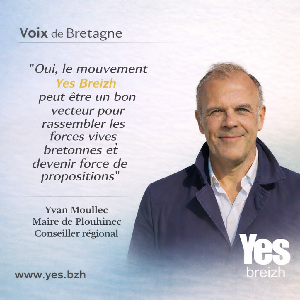
Find testimonials from Breton women and men, of which that of Yvan Moullec, Mayor of Plouhinec in Finistère
To support Yes Breizh : HelloAsso
To support Yes Breizh : PayPal
To join Yes Breizh : Yes Breizh membership